
München
80 München-Schwanthalerhöhe, Deutschland
Schwanthalerhöhe | U-Bahn & Parking
Schwanthalerhöhe is one of the most exciting districts of Munich because many inquiries converge here that are usually considered separately: U-Bahn, parking, route, maps, forum, cafés, restaurants, and history. This very mix makes the district so interesting for visitors, residents, and anyone who wants to quickly orient themselves before a city stroll, an event, or an appointment. District 8 forms the western inner city fringe and is located on the Isar low terrace. It is closely linked to the development of Munich in the 19th and 20th centuries, with the old working-class neighborhoods of the West End, the former trade fair, and the current neighborhoods on Theresienhöhe. So, those looking for Schwanthalerhöhe are not just looking for a point on the map, but a piece of urban history that unfolds between railway tracks, green spaces, cultural sites, and urban everyday life. ([stadt.muenchen.de](https://stadt.muenchen.de/infos/bezirk8_schwanthalerhoehe.html))
Location, History, and Change in the West End
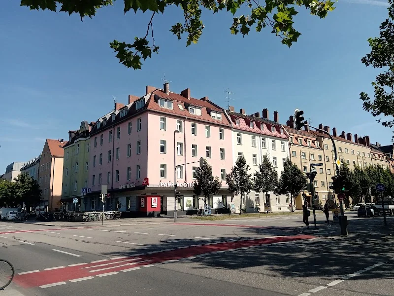
Schwanthalerhöhe is located west of the city center and is bordered by the railway lines Hauptbahnhof-Pasing and Hauptbahnhof-Ostbahnhof. The city of Munich describes the district as a western inner city fringe that lies on the Isar low terrace and whose emergence is closely linked to industrialization from around 1840. This development led to Gründerzeit working-class neighborhoods with dense block construction, a large part of which has been preserved to this day. Almost half of the housing stock still dates from before 1919, and the West End, with its cooperative settlements around 1900, vividly illustrates how social housing, urban densification, and urban history interact. Therefore, Schwanthalerhöhe is not only an inner-city residential location but also a vibrant example of Munich's transformation from a working and industrial city to a diverse service and cultural city. ([stadt.muenchen.de](https://stadt.muenchen.de/infos/bezirk8_schwanthalerhoehe.html))
Particularly influential is the area around Theresienhöhe, where a new urban quarter emerged after the relocation of the Munich Trade Fair to Riem in February 1998. The city mentions an area of 47.1 hectares, more than 4,000 jobs, over 1,400 apartments, and numerous follow-up facilities such as primary schools and daycare centers. Additionally, there are publicly subsidized rental apartments as well as green and open spaces that significantly enhance the area. At the same time, the historical core of the West End has been preserved: renovations have transformed the once rather rough glass shard district into a trendy quarter without completely losing its original character. This tension between old and new, between dense urban fabric and new neighborhood development, is an important reason why Schwanthalerhöhe is so present in Munich's search behavior. ([stadt.muenchen.de](https://stadt.muenchen.de/infos/bezirk8_schwanthalerhoehe.html))
Moreover, architectural landmarks make the district well-known far beyond its borders. The city of Munich explicitly names Bavaria, the Ruhmeshalle, and the Hauptzollamt as architectural jewels of Schwanthalerhöhe. So when people speak of the district, they are referring not only to a residential area but also to a place with strong symbols of Munich's identity. Bavaria towers over the Theresienwiese, the Ruhmeshalle recalls Munich's representative architectural history, and the Hauptzollamt is a striking part of the urban ensemble. These places are part of an urban memory that can be felt immediately when walking through Schwanthalerhöhe. ([stadt.muenchen.de](https://stadt.muenchen.de/service/info/schwanthalerhohe/10314002/))
U-Bahn, S-Bahn, Tram, and the Best Route
For many people, Schwanthalerhöhe is primarily a matter of quick access. The most important reference point is the U-Bahn station Schwanthalerhöhe, which, according to MVV, is located on the U-Bahn lines U4 and U5 and is situated at Theresienhöhe near Theresienwiese. The station belongs to zone M and is barrier-free, although access to the U-Bahn is possible via a step. There are also MVV ticket machines, a time ticket machine, and a U-Bahn kiosk. So, if someone searches for Schwanthalerhöhe U-Bahn, U-Bahn map, or route, they quickly land at this transport hub. The station has been called Schwanthalerhöhe since 1998; previously, it was named Messegelände, which is still evident from the figures, flags, and wall graphics in the station. ([mvv-muenchen.de](https://www.mvv-muenchen.de/plaene-bahnhoefe/bahnhofsinformation/station/schwanthalerhoehe/index.html))
For practical route planning, the combination of U-Bahn, S-Bahn, and tram is particularly important. According to the official visitor information for the Forum Schwanthalerhöhe, one travels with U4 or U5 to Schwanthalerhöhe, with bus 53 also to the Schwanthalerhöhe stop, with bus 134 to Alter Messeplatz, with the S-Bahn to Hackerbrücke and from there about 15 minutes on foot, or with tram lines 18 and 19 to Holzapfelstraße. The MVV provides a station map and an orientation plan, which is particularly helpful when preparing for an appointment, an event, or a city stroll. Those coming from the city center can use Schwanthalerhöhe very well as a hub between Hauptbahnhof, Theresienwiese, and Westend. The district is so close to the city that many routes also work well on foot, while at the same time, it is so well connected that one hardly has to rely on a car. ([mvv-muenchen.de](https://www.mvv-muenchen.de/plaene-bahnhoefe/bahnhofsinformation/station/schwanthalerhoehe/index.html))
Parking at Schwanthalerhöhe and Around the Forum
The interest in parking at Schwanthalerhöhe is understandable, as the district is located in the middle of a densely built, traffic-heavy urban area. The official visitor information for the Forum Schwanthalerhöhe states the address for arriving by car as Theresienhöhe 5, 80339 Munich. Nearby parking options include the Theresienwiese parking lot, the Forum Schwanthalerhöhe parking garage, and the Heimeranstraße parking garage. At the same time, the organizer explicitly recommends arriving by public transport. This recommendation fits the location of the district, which is in close proximity to the city center and is particularly well accessible by U-Bahn, tram, and S-Bahn. For visitors who want to be on-site quickly, the clear rule is simple: first check if U4, U5, tram, or S-Bahn are the more convenient options, and only if necessary, drive by car. ([forscha.de](https://forscha.de/fo/besucher))
The surrounding urban infrastructure also shows that the district is strongly focused on mobility, transfers, and short distances. The MVV station plan documents not only the U-Bahn station itself but also the service points, ticket machines, and barrier-free accessibility. In practice, this means: those searching for Schwanthalerhöhe with route or maps should not only pay attention to car navigation but also consciously consider the stop landscape. Especially for events at the Forum, in the transport center, or during city strolls in the West End, the combination of public transport and walking is often the most efficient solution. This is especially true when a destination is located at Theresienhöhe, Bavariapark, or in the area of the old trade fair. Thus, Schwanthalerhöhe becomes not only a destination for drivers but also a very well-connected urban hub. ([mvv-muenchen.de](https://www.mvv-muenchen.de/plaene-bahnhoefe/bahnhofsinformation/station/schwanthalerhoehe/index.html))
Forum Schwanthalerhöhe, Transport Center, and Events
An important search topic around Schwanthalerhöhe is the Forum Schwanthalerhöhe. The official information pages for the Forum show that the place is repeatedly used as an event space, for example, for the Munich Science Days with the Explorer Realm of FORSCHA. There, free admission, participation programs, hall plans, timetables, and various program formats are mentioned. For visitors, it is particularly relevant that the Forum is located at Theresienhöhe 5 and is accessible by U4, U5, bus 53, bus 134, S-Bahn via Hackerbrücke, and tram 18/19. Thus, the Forum plays the same role in the district as a modern urban anchor: it brings people, topics, and routes together and makes Schwanthalerhöhe a location for temporary events, family programs, and knowledge formats. Therefore, those searching for Schwanthalerhöhe Forum usually mean more than just a single building; they are looking for a place where urban life can be practically experienced. ([forscha.de](https://forscha.de/fo/besucher))
A second strong attraction is the transport center of the Deutsches Museum at Theresienhöhe, which is described by muenchen.de as a museum for transport, technology, and mobility. It mentions the location on the site of the old trade fair, as well as access via U4/U5 or bus 53 to Schwanthalerhöhe and bus 134 to Theresienhöhe, as well as parking at the Theresienwiese parking lot or in the Heimeranstraße parking garage. On 12,000 square meters, around 275 historical vehicles, motorcycles, bicycles, and carriages can be seen; the exhibition is divided into three halls and focuses on urban transport, travel, and mobility on land. Thus, right next to the Forum lies a cultural highlight that makes Schwanthalerhöhe interesting far beyond a normal city district. The combination of exhibition, event spaces, and urban development is a core argument for why this district covers so many different search intentions. ([muenchen.de](https://www.muenchen.de/sehenswuerdigkeiten/museen/deutsches-museum-verkehrszentrum?utm_source=openai))
Restaurants, Cafés, and Urban Supply in the West End
The keywords around Schwanthalerhöhe restaurant, Schwanthalerhöhe cafe, Schwanthalerhöhe bar, Schwanthalerhöhe sushi, and Schwanthalerhöhe all you can eat show one thing above all: people expect a functioning, vibrant urban quarter here with many everyday offerings. This fits the structure of the district. The city of Munich describes Schwanthalerhöhe as an area where nearly two-thirds of jobs are now in services, trade, and public administration. The eastern, city-center-adjacent part serves as a bridgehead to the city with a supra-regional service and consumer goods offering. This means that those traveling in Schwanthalerhöhe will find not only residential streets and historical sites but also an environment where lunch breaks, dinners, coffee in between, or a meeting point before an event are naturally part of urban reality. For SEO, this very mix is crucial because it sensibly links search queries for restaurants and cafés to the location. ([stadt.muenchen.de](https://stadt.muenchen.de/infos/bezirk8_schwanthalerhoehe.html))
An official city walk of the state capital provides a good example of this urban mix: it begins at a new building of the Rischart bakery, which houses not only the bakery but also the company headquarters, factory apartments, a boarding house, and a café. The tour then leads over the neighborhood square Theresienhöhe to the Moll blocks, further over the Georg-Freundorfer-Platz to the traditional Ledigenheim München and finally into Gollierstraße. This route vividly shows that Schwanthalerhöhe is a district where work, living, supply, and gastronomy are closely intertwined. Those looking for a café, a quick meal, or a place to meet before an appointment benefit from a dense, mixed-use urban structure here. Even though the individual search terms sound very different, they all express the same desire: to find a functional, urban place with good supply and a short distance to the most important destinations. ([veranstaltungen.muenchen.de](https://veranstaltungen.muenchen.de/plan/veranstaltungen/stadtspaziergang-schwanthalerhoehe/?utm_source=openai))
Green Spaces, Architecture, and Special Places in Schwanthalerhöhe
Despite its density, Schwanthalerhöhe is not just gray and traffic-heavy. The city of Munich highlights the Bavariapark as well as several smaller squares that provide the district with greenery and quality of stay. The senior citizens' representation names Bavariapark as the largest recreational area in the district, followed by Gollierplatz and Georg-Freundorfer-Platz with its award-winning playground from 2006. Additionally, there is the Arnulfsteg, a foot and bike bridge that crosses the 37 railway tracks of the main line over a length of 240 meters and creates a barrier-free connection between Schwanthalerhöhe, Arnulfpark, and Maxvorstadt. These places are important because they show that the district is not only made up of traffic, history, and commerce but also of open spaces, play areas, and paths that make everyday life more pleasant. Those who want to not just pass through Schwanthalerhöhe but experience it should also consider the squares, parks, and cross-connections. ([stadt.muenchen.de](https://stadt.muenchen.de/infos/bezirk8_schwanthalerhoehe.html))
Architecturally, the district thrives on contrast. On one side stand historical testimonies such as Bavaria, Ruhmeshalle, and Hauptzollamt, while on the other side is the new quarter on the former trade fair grounds with apartments, workplaces, and facilities for daily needs. This creates an urban landscape that goes far beyond what many associate with a classic inner-city district. For walks, this mix is ideal because one can experience very different urban spaces over a short distance: dense block edges, open squares, modern residential buildings, cultural sites, and green islands. This is exactly what makes Schwanthalerhöhe such an interesting destination for maps, routes, and urban exploration. Those who arrive here move in a district that does not hide its history but has integrated it into the urban space. And precisely because Schwanthalerhöhe offers so many facets, it is one of the most exciting addresses in western Munich for both quick everyday routes and longer discovery tours. ([stadt.muenchen.de](https://stadt.muenchen.de/service/info/schwanthalerhohe/10314002/))
Sources:
Show moreShow less
Schwanthalerhöhe | U-Bahn & Parking
Schwanthalerhöhe is one of the most exciting districts of Munich because many inquiries converge here that are usually considered separately: U-Bahn, parking, route, maps, forum, cafés, restaurants, and history. This very mix makes the district so interesting for visitors, residents, and anyone who wants to quickly orient themselves before a city stroll, an event, or an appointment. District 8 forms the western inner city fringe and is located on the Isar low terrace. It is closely linked to the development of Munich in the 19th and 20th centuries, with the old working-class neighborhoods of the West End, the former trade fair, and the current neighborhoods on Theresienhöhe. So, those looking for Schwanthalerhöhe are not just looking for a point on the map, but a piece of urban history that unfolds between railway tracks, green spaces, cultural sites, and urban everyday life. ([stadt.muenchen.de](https://stadt.muenchen.de/infos/bezirk8_schwanthalerhoehe.html))
Location, History, and Change in the West End
Schwanthalerhöhe is located west of the city center and is bordered by the railway lines Hauptbahnhof-Pasing and Hauptbahnhof-Ostbahnhof. The city of Munich describes the district as a western inner city fringe that lies on the Isar low terrace and whose emergence is closely linked to industrialization from around 1840. This development led to Gründerzeit working-class neighborhoods with dense block construction, a large part of which has been preserved to this day. Almost half of the housing stock still dates from before 1919, and the West End, with its cooperative settlements around 1900, vividly illustrates how social housing, urban densification, and urban history interact. Therefore, Schwanthalerhöhe is not only an inner-city residential location but also a vibrant example of Munich's transformation from a working and industrial city to a diverse service and cultural city. ([stadt.muenchen.de](https://stadt.muenchen.de/infos/bezirk8_schwanthalerhoehe.html))
Particularly influential is the area around Theresienhöhe, where a new urban quarter emerged after the relocation of the Munich Trade Fair to Riem in February 1998. The city mentions an area of 47.1 hectares, more than 4,000 jobs, over 1,400 apartments, and numerous follow-up facilities such as primary schools and daycare centers. Additionally, there are publicly subsidized rental apartments as well as green and open spaces that significantly enhance the area. At the same time, the historical core of the West End has been preserved: renovations have transformed the once rather rough glass shard district into a trendy quarter without completely losing its original character. This tension between old and new, between dense urban fabric and new neighborhood development, is an important reason why Schwanthalerhöhe is so present in Munich's search behavior. ([stadt.muenchen.de](https://stadt.muenchen.de/infos/bezirk8_schwanthalerhoehe.html))
Moreover, architectural landmarks make the district well-known far beyond its borders. The city of Munich explicitly names Bavaria, the Ruhmeshalle, and the Hauptzollamt as architectural jewels of Schwanthalerhöhe. So when people speak of the district, they are referring not only to a residential area but also to a place with strong symbols of Munich's identity. Bavaria towers over the Theresienwiese, the Ruhmeshalle recalls Munich's representative architectural history, and the Hauptzollamt is a striking part of the urban ensemble. These places are part of an urban memory that can be felt immediately when walking through Schwanthalerhöhe. ([stadt.muenchen.de](https://stadt.muenchen.de/service/info/schwanthalerhohe/10314002/))
U-Bahn, S-Bahn, Tram, and the Best Route
For many people, Schwanthalerhöhe is primarily a matter of quick access. The most important reference point is the U-Bahn station Schwanthalerhöhe, which, according to MVV, is located on the U-Bahn lines U4 and U5 and is situated at Theresienhöhe near Theresienwiese. The station belongs to zone M and is barrier-free, although access to the U-Bahn is possible via a step. There are also MVV ticket machines, a time ticket machine, and a U-Bahn kiosk. So, if someone searches for Schwanthalerhöhe U-Bahn, U-Bahn map, or route, they quickly land at this transport hub. The station has been called Schwanthalerhöhe since 1998; previously, it was named Messegelände, which is still evident from the figures, flags, and wall graphics in the station. ([mvv-muenchen.de](https://www.mvv-muenchen.de/plaene-bahnhoefe/bahnhofsinformation/station/schwanthalerhoehe/index.html))
For practical route planning, the combination of U-Bahn, S-Bahn, and tram is particularly important. According to the official visitor information for the Forum Schwanthalerhöhe, one travels with U4 or U5 to Schwanthalerhöhe, with bus 53 also to the Schwanthalerhöhe stop, with bus 134 to Alter Messeplatz, with the S-Bahn to Hackerbrücke and from there about 15 minutes on foot, or with tram lines 18 and 19 to Holzapfelstraße. The MVV provides a station map and an orientation plan, which is particularly helpful when preparing for an appointment, an event, or a city stroll. Those coming from the city center can use Schwanthalerhöhe very well as a hub between Hauptbahnhof, Theresienwiese, and Westend. The district is so close to the city that many routes also work well on foot, while at the same time, it is so well connected that one hardly has to rely on a car. ([mvv-muenchen.de](https://www.mvv-muenchen.de/plaene-bahnhoefe/bahnhofsinformation/station/schwanthalerhoehe/index.html))
Parking at Schwanthalerhöhe and Around the Forum
The interest in parking at Schwanthalerhöhe is understandable, as the district is located in the middle of a densely built, traffic-heavy urban area. The official visitor information for the Forum Schwanthalerhöhe states the address for arriving by car as Theresienhöhe 5, 80339 Munich. Nearby parking options include the Theresienwiese parking lot, the Forum Schwanthalerhöhe parking garage, and the Heimeranstraße parking garage. At the same time, the organizer explicitly recommends arriving by public transport. This recommendation fits the location of the district, which is in close proximity to the city center and is particularly well accessible by U-Bahn, tram, and S-Bahn. For visitors who want to be on-site quickly, the clear rule is simple: first check if U4, U5, tram, or S-Bahn are the more convenient options, and only if necessary, drive by car. ([forscha.de](https://forscha.de/fo/besucher))
The surrounding urban infrastructure also shows that the district is strongly focused on mobility, transfers, and short distances. The MVV station plan documents not only the U-Bahn station itself but also the service points, ticket machines, and barrier-free accessibility. In practice, this means: those searching for Schwanthalerhöhe with route or maps should not only pay attention to car navigation but also consciously consider the stop landscape. Especially for events at the Forum, in the transport center, or during city strolls in the West End, the combination of public transport and walking is often the most efficient solution. This is especially true when a destination is located at Theresienhöhe, Bavariapark, or in the area of the old trade fair. Thus, Schwanthalerhöhe becomes not only a destination for drivers but also a very well-connected urban hub. ([mvv-muenchen.de](https://www.mvv-muenchen.de/plaene-bahnhoefe/bahnhofsinformation/station/schwanthalerhoehe/index.html))
Forum Schwanthalerhöhe, Transport Center, and Events
An important search topic around Schwanthalerhöhe is the Forum Schwanthalerhöhe. The official information pages for the Forum show that the place is repeatedly used as an event space, for example, for the Munich Science Days with the Explorer Realm of FORSCHA. There, free admission, participation programs, hall plans, timetables, and various program formats are mentioned. For visitors, it is particularly relevant that the Forum is located at Theresienhöhe 5 and is accessible by U4, U5, bus 53, bus 134, S-Bahn via Hackerbrücke, and tram 18/19. Thus, the Forum plays the same role in the district as a modern urban anchor: it brings people, topics, and routes together and makes Schwanthalerhöhe a location for temporary events, family programs, and knowledge formats. Therefore, those searching for Schwanthalerhöhe Forum usually mean more than just a single building; they are looking for a place where urban life can be practically experienced. ([forscha.de](https://forscha.de/fo/besucher))
A second strong attraction is the transport center of the Deutsches Museum at Theresienhöhe, which is described by muenchen.de as a museum for transport, technology, and mobility. It mentions the location on the site of the old trade fair, as well as access via U4/U5 or bus 53 to Schwanthalerhöhe and bus 134 to Theresienhöhe, as well as parking at the Theresienwiese parking lot or in the Heimeranstraße parking garage. On 12,000 square meters, around 275 historical vehicles, motorcycles, bicycles, and carriages can be seen; the exhibition is divided into three halls and focuses on urban transport, travel, and mobility on land. Thus, right next to the Forum lies a cultural highlight that makes Schwanthalerhöhe interesting far beyond a normal city district. The combination of exhibition, event spaces, and urban development is a core argument for why this district covers so many different search intentions. ([muenchen.de](https://www.muenchen.de/sehenswuerdigkeiten/museen/deutsches-museum-verkehrszentrum?utm_source=openai))
Restaurants, Cafés, and Urban Supply in the West End
The keywords around Schwanthalerhöhe restaurant, Schwanthalerhöhe cafe, Schwanthalerhöhe bar, Schwanthalerhöhe sushi, and Schwanthalerhöhe all you can eat show one thing above all: people expect a functioning, vibrant urban quarter here with many everyday offerings. This fits the structure of the district. The city of Munich describes Schwanthalerhöhe as an area where nearly two-thirds of jobs are now in services, trade, and public administration. The eastern, city-center-adjacent part serves as a bridgehead to the city with a supra-regional service and consumer goods offering. This means that those traveling in Schwanthalerhöhe will find not only residential streets and historical sites but also an environment where lunch breaks, dinners, coffee in between, or a meeting point before an event are naturally part of urban reality. For SEO, this very mix is crucial because it sensibly links search queries for restaurants and cafés to the location. ([stadt.muenchen.de](https://stadt.muenchen.de/infos/bezirk8_schwanthalerhoehe.html))
An official city walk of the state capital provides a good example of this urban mix: it begins at a new building of the Rischart bakery, which houses not only the bakery but also the company headquarters, factory apartments, a boarding house, and a café. The tour then leads over the neighborhood square Theresienhöhe to the Moll blocks, further over the Georg-Freundorfer-Platz to the traditional Ledigenheim München and finally into Gollierstraße. This route vividly shows that Schwanthalerhöhe is a district where work, living, supply, and gastronomy are closely intertwined. Those looking for a café, a quick meal, or a place to meet before an appointment benefit from a dense, mixed-use urban structure here. Even though the individual search terms sound very different, they all express the same desire: to find a functional, urban place with good supply and a short distance to the most important destinations. ([veranstaltungen.muenchen.de](https://veranstaltungen.muenchen.de/plan/veranstaltungen/stadtspaziergang-schwanthalerhoehe/?utm_source=openai))
Green Spaces, Architecture, and Special Places in Schwanthalerhöhe
Despite its density, Schwanthalerhöhe is not just gray and traffic-heavy. The city of Munich highlights the Bavariapark as well as several smaller squares that provide the district with greenery and quality of stay. The senior citizens' representation names Bavariapark as the largest recreational area in the district, followed by Gollierplatz and Georg-Freundorfer-Platz with its award-winning playground from 2006. Additionally, there is the Arnulfsteg, a foot and bike bridge that crosses the 37 railway tracks of the main line over a length of 240 meters and creates a barrier-free connection between Schwanthalerhöhe, Arnulfpark, and Maxvorstadt. These places are important because they show that the district is not only made up of traffic, history, and commerce but also of open spaces, play areas, and paths that make everyday life more pleasant. Those who want to not just pass through Schwanthalerhöhe but experience it should also consider the squares, parks, and cross-connections. ([stadt.muenchen.de](https://stadt.muenchen.de/infos/bezirk8_schwanthalerhoehe.html))
Architecturally, the district thrives on contrast. On one side stand historical testimonies such as Bavaria, Ruhmeshalle, and Hauptzollamt, while on the other side is the new quarter on the former trade fair grounds with apartments, workplaces, and facilities for daily needs. This creates an urban landscape that goes far beyond what many associate with a classic inner-city district. For walks, this mix is ideal because one can experience very different urban spaces over a short distance: dense block edges, open squares, modern residential buildings, cultural sites, and green islands. This is exactly what makes Schwanthalerhöhe such an interesting destination for maps, routes, and urban exploration. Those who arrive here move in a district that does not hide its history but has integrated it into the urban space. And precisely because Schwanthalerhöhe offers so many facets, it is one of the most exciting addresses in western Munich for both quick everyday routes and longer discovery tours. ([stadt.muenchen.de](https://stadt.muenchen.de/service/info/schwanthalerhohe/10314002/))
Sources:
Upcoming Events
No events found
Frequently Asked Questions
Reviews
No reviews found